Lancaster and Morecambe aerial images from past 100 years now on show through new online tool
and live on Freeview channel 276
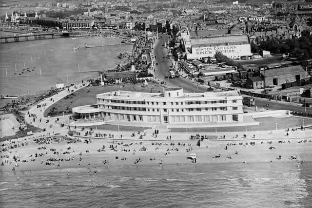
Historic England have launched a new Aerial Photograph Explorer, giving you the chance to zoom in on anywhere in the country and look at aerial photos of the area or local landmarks.
The imagery provides a fascinating insight into our changing landscape and reveals striking discoveries such as ‘crop marks’, showing hidden archaeology beneath the surface, and more, including the remains of ancient archaeology, Second World War anti-invasion measures, war-time adaptations to sites, bomb damage, 20th century industrial sites and famous buildings.
Advertisement
Hide AdAdvertisement
Hide AdMore than 400,000 images from 1919 to the present day have been added to the tool, covering nearly 30 per cent of England.

Click here to access the nationally important collections of aerial photographs to explore wherever you wish.
Why not find the place where you live, or maybe look for your favourite football ground, railway station or the places you visit?